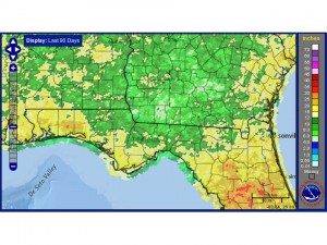
Dr. David Zierden, the Florida State Climatologist and I have been discussing the 2014 weather for the Southeast. I suggested the similarities in crop conditions between 2011 and 2014, and we have looked at the rainfall totals for the 90 day June-July-August period. In 2011 we had a dry spring capped off with May being very dry across the entire region. So the growing season was behind going in. This year we had a wet spring and very wet year prior, so soil moisture and groundwater was in far better shape this year.
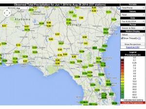
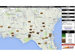
The next two slides shows station observations and historical rankings for rainfall since June 1st. At Tallahassee we’ve only recorded 8.66″, which will be a record if we don’t get any more before the end of the month. Other spots in South Georgia also rank as the driest on record. These conditions do appear very similar to 2011, with potentially less rainfall recorded in 2014 for the June-July-August period critical to the production of our corn, cotton, and peanut crops. In fact, with many stations showing a ranking of 1, this is the lowest recorded JJA rainfall at those weather stations. Thanks to Dr. David Zierden for images and additional commentary.


